
The Realsee Galois M200 / P4: Mapping-Grade Capture Without the Data Ransom
Navigating tight stairwells, complex vertical transitions, and multi-level floorplans is where most automated scanning rigs fall apart, but the Galois handles them with remarkable composure. Delivering crisp, high-fidelity imagery alongside clean meshes and dense point clouds, it bridges the gap between rapid visual tours and genuinely useful spatial mapping.
.
The real triumph, however, lies in how it treats your data. Instead of trapping your captures behind restrictive cloud walls, demanding recurring monthly subscriptions, or charging you to buy back your own hard-won visual assets with add-on bundles and "PAKs," it leaves complete ownership where it belongs: in your hands. You capture the environment, extract the raw point clouds and meshes, and feed them directly into your preferred modelling pipeline with zero gatekeeping or ongoing ransom fees. It is robust, capable hardware that simply gets on with the job.

The iGuide PLANIX: Effortless Spatial Baselines and True Floorplan Autonomy
When walking into a facility where the architectural drawings are either decades out of date or entirely nonexistent, the iGuide PLANIX is the ultimate leveller. Compact, remarkably simple to operate, and fast on site, it takes the guesswork out of building documentation by generating clean 360-degree imagery alongside millimeter-accurate lidar measurements in a single pass. It provides the perfect baseline for creating intuitive, responsive wayfinding maps, updating marketing layouts, and tracking physical asset modifications as tenant spaces evolve over time.
Crucially, it respects the surveyor’s cardinal rule: data sovereignty. You aren't boxed into rigid hosting dependencies or punitive subscription models just to keep your building records alive. The floorplans, imagery, and metric layouts belong entirely to you, ready to be exported directly into your own mapping platforms and modeling workflows. It delivers crisp, reliable spatial foundations without the administrative friction.
The Rothbucher Handshake: The Universal Anchor for Mixed-Reality Spatial Data
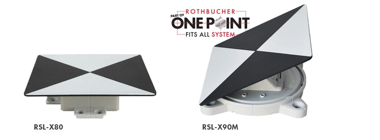
When blending disparate spatial datasets—terrestrial laser scans, drone photogrammetry, close-range arrays, 360-degree imagery, SLAM trails, and Gaussian splats—the biggest hurdle is getting different instruments to agree on where the physical world actually sits. That is where the Rothbucher ‘Handshake' comes in.
By anchoring every capture session to fixed, physical Rothbucher target systems, you establish an immutable survey-grade datum across all instruments and point clouds. Whether stuck firmly to a windowpane, clamped to a run of scaffolding, or affixed neatly into a plug socket (provided you make a note of which plug socket you picked), these discrete reference points turn floating coordinate systems into rigorous, georeferenced truth.
More importantly, the handshake pays compounding dividends over time. When you return to a structure months or years later, re-engaging the exact same control points lets you overlay fresh data directly onto historic baselines. Minute movements, structural settlement, progressive cracking, and gradual dilapidation reveal themselves with absolute metric confidence.
For multi-disciplinary teams capturing, modelling, and sharing disparate datasets, establishing a physical Rothbucher handshake isn't just tidy surveying discipline—it is the single most reliable safeguard against cumulative drift and mismatched digital realities.
